Oak Grove, South Carolina
Oak Grove, South Carolina | |
|---|---|
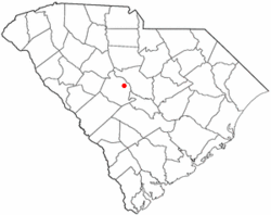
 Location of Oak Grove, South Carolina | |
| Coordinates: 33°58′26″N 81°9′23″W / 33.97389°N 81.15639°W | |
| Country | United States |
| State | South Carolina |
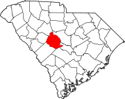
| County | Lexington |
| Area | |
| • Total | 7.61 sq mi (19.71 km2) |
| • Land | 7.58 sq mi (19.64 km2) |
| • Water | 0.03 sq mi (0.07 km2) |
| Elevation | 341 ft (104 m) |
| Population | |
| • Total | 12,899 |
| • Density | 1,700.59/sq mi (656.63/km2) |
| Time zone | UTC-5 (Eastern (EST)) |
| • Summer (DST) | UTC-4 (EDT) |
| FIPS code | 45-51720[4] |
| GNIS feature ID | 2407593[2] |
Oak Grove is a census-designated place (CDP) in Lexington County, South Carolina, United States. The population was 10,291 at the 2010 census.[5] It is part of the Columbia Metropolitan Statistical Area.
Geography
[edit]Oak Grove is located in eastern Lexington County at 33°58′48″N 81°8′25″W / 33.98000°N 81.14028°W (33.980098, -81.140291),[6] 8 miles (13 km) west of downtown Columbia, the state capital. It is bordered to the east by West Columbia and to the southeast by Springdale. U.S. Route 1 (Augusta Road) is the main road through Oak Grove; it leads east (northbound) into Columbia and west (southbound) 5 miles (8 km) to Lexington, the county seat.
According to the United States Census Bureau, the CDP has a total area of 6.4 square miles (16.7 km2), of which 0.02 square miles (0.04 km2), or 0.26%, are water.[7]
Demographics
[edit]| Census | Pop. | Note | %± |
|---|---|---|---|
| 2020 | 12,899 | — | |
| U.S. Decennial Census[8] | |||
2020 census
[edit]| Race | Num. | Perc. |
|---|---|---|
| White (non-Hispanic) | 8,904 | 69.03% |
| Black or African American (non-Hispanic) | 1,580 | 12.25% |
| Native American | 35 | 0.27% |
| Asian | 250 | 1.94% |
| Pacific Islander | 1 | 0.01% |
| Other/Mixed | 663 | 5.14% |
| Hispanic or Latino | 1,466 | 11.37% |
As of the 2020 United States census, there were 12,899 people, 4,446 households, and 2,640 families residing in the CDP.
2000 census
[edit]As of the census[4] of 2000, there were 8,183 people, 3,368 households, and 2,320 families residing in the CDP. The population density was 1,214.2 inhabitants per square mile (468.8/km2). There were 3,626 housing units at an average density of 538.0 per square mile (207.7/km2). The racial makeup of the CDP was 88.45% White, 8.19% African American, 0.34% Native American, 1.03% Asian, 0.01% Pacific Islander, 0.82% from other races, and 1.16% from two or more races. Hispanic or Latino of any race were 2.25% of the population.
There were 3,368 households, out of which 32.3% had children under the age of 18 living with them, 52.9% were married couples living together, 12.7% had a female householder with no husband present, and 31.1% were non-families. 25.0% of all households were made up of individuals, and 7.9% had someone living alone who was 65 years of age or older. The average household size was 2.43 and the average family size was 2.90.
In the CDP, the population was spread out, with 24.2% under the age of 18, 7.2% from 18 to 24, 35.2% from 25 to 44, 23.6% from 45 to 64, and 9.8% who were 65 years of age or older. The median age was 36 years. For every 100 females, there were 93.7 males. For every 100 females age 18 and over, there were 91.9 males.
The median income for a household in the CDP was $42,338, and the median income for a family was $48,904. Males had a median income of $31,511 versus $25,845 for females. The per capita income for the CDP was $19,509. About 2.6% of families and 4.8% of the population were below the poverty line, including 5.3% of those under age 18 and 7.5% of those age 65 or over.
References
[edit]- ^ "ArcGIS REST Services Directory". United States Census Bureau. Retrieved October 15, 2022.
- ^ a b U.S. Geological Survey Geographic Names Information System: Oak Grove, South Carolina
- ^ "Census Population API". United States Census Bureau. Retrieved October 15, 2022.
- ^ a b "U.S. Census website". United States Census Bureau. Retrieved January 31, 2008.
- ^ "Total Population: 2010 Census DEC Summary File 1 (P1), Oak Grove CDP, South Carolina". data.census.gov. U.S. Census Bureau. Retrieved December 29, 2020.
- ^ "US Gazetteer files: 2010, 2000, and 1990". United States Census Bureau. February 12, 2011. Retrieved April 23, 2011.
- ^ "2019 U.S. Gazetteer Files". United States Census Bureau. Retrieved December 29, 2020.
- ^ "Census of Population and Housing". Census.gov. Retrieved June 4, 2016.
- ^ "Explore Census Data". data.census.gov. Retrieved December 14, 2021.

