Mukhavets
Appearance
| Mukhavets River | |
|---|---|
 | |
 | |
| Location | |
| Country | Belarus |
| Physical characteristics | |
| Source | Confluence of River Mukha and Viets Canal |
| • location | Pruzhany, Belarus |
| • coordinates | 52°33′48.96″N 24°27′8.28″E / 52.5636000°N 24.4523000°E |
| Mouth | Bug |
• location | Brest |
• coordinates | 52°4′52.11″N 23°39′8.5″E / 52.0811417°N 23.652361°E |
| Length | 113 km (70 mi) |
| Basin size | 6,600 km2 (2,500 sq mi) |
| Discharge | |
| • average | 33.6 m3/s (1,190 cu ft/s) |
| Basin features | |
| Progression | Bug→ Narew→ Vistula→ Baltic Sea |
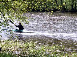
The Mukhavets (Belarusian: Мухавец, romanized: Mukhaviets [muxaˈvʲets]; Russian: Муховец, romanized: Mukhovets, Polish: Muchawiec) is a river in western Belarus.
A tributary of the Bug River, the Mukhavets rises in Pruzhany, Belarus, where the Mukha river and the Vyets canal converge, flows through south-western Belarus and merges with the Bug River in Brest.
The river is 113 km long with a 6,600 km2 (2,500 sq mi) basin area.
The Mukhavets is connected with the Dnieper river by the Dnieper–Bug Canal.
Cities
[edit]Tributaries
[edit]External links
[edit]Books
[edit]- (in Russian, English and Polish) Ye.N.Meshechko, A.A.Gorbatsky (2005) Belarusian Polesye: Tourist Transeuropean Water Mains, Minsk, Four Quarters
52°05′01″N 23°38′54″E / 52.0835°N 23.6482°E
