Velen
Appearance
Velen | |
|---|---|
 Velen Castle | |
| Coordinates: 51°53′38″N 06°59′23″E / 51.89389°N 6.98972°E | |
| Country | Germany |
| State | North Rhine-Westphalia |
| Admin. region | Münster |
| District | Borken |
| Subdivisions | 6 |
| Government | |
| • Mayor (2020–25) | Dagmar Jeske[1] |
| Area | |
| • Total | 70.52 km2 (27.23 sq mi) |
| Elevation | 57 m (187 ft) |
| Population (2023-12-31)[2] | |
| • Total | 13,381 |
| • Density | 190/km2 (490/sq mi) |
| Time zone | UTC+01:00 (CET) |
| • Summer (DST) | UTC+02:00 (CEST) |
| Postal codes | 46342 |
| Dialling codes | 0 28 63 |
| Vehicle registration | AH, BOH, BOR |
| Website | www |
Velen is a town in the district Borken, North Rhine-Westphalia, Germany with about 12,000 citizens. It consists of the two settlements of Velen and Ramsdorf and the four rural regions Ostendorf-Krueckling, Bleking-Holthausen, Nordvelen and Waldvelen. In 2003 the town received the title "staatlich anerkannter Erholungsort" (recreation village approved by the state) from the regional president. Since August 2012 it is a town. It was arwarded the title "annerkannter Luftkurort" (state-approved climatic health resort) in January of 2023.
Personalities
[edit]- Hendrickje Stoffels (1626-1663), partner of the Dutch Baroque painter Rembrandt
- Ludwig Averkamp (1927-2013), Archbishop of Hamburg
- Klaus Balkenhol (born 1939), German dressage rider
- Georg Veit (born 1956), writer
- Marv Terhoch, son of Velen-born Kurt Terhoch, refugee to Canada in 1939
-
Hendrickje Stoffels
-
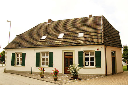
The Humberghaus Dingden, near by Velen, from 1814, home of Kurt's mother Freda (Frieda) Terhoch
References
[edit]- ^ Wahlergebnisse in NRW Kommunalwahlen 2020, Land Nordrhein-Westfalen, accessed 19 June 2021.
- ^ "Bevölkerung der Gemeinden Nordrhein-Westfalens am 31. Dezember 2023 – Fortschreibung des Bevölkerungsstandes auf Basis des Zensus vom 9. Mai 2011" (in German). Landesbetrieb Information und Technik NRW. Retrieved 2024-06-20.


